Community
Weak Cold Front To Bring Cooler Weekend Temperatures
By Marcus Chen
Advertisement · Why this ad?
Katherine oversees editorial operations across all six brands. Before joining The Meridan Group, she spent 14 years at the Minneapolis Star Tribune, where she led the metro desk through its digital transformation. She holds a Master's in Journalism from Northwestern's Medill School.
More from Katherine →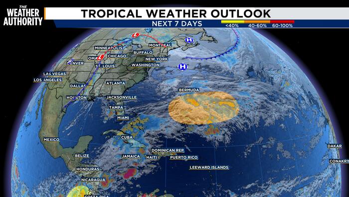
An Atlantic Gale Warning is in place as a broad area of low pressure is expected to develop tonight along an old frontal boundary near the Bahamas.A very tight pressure gradient between the low pressure and strong high pressure to its north is expected to produce near-gale to gale-force northeast to east winds beginning tomorrow afternoon.Seas are expected to build to 10-16 ft with these winds through Thursday as the low pressure drifts east-northeastward. The low pressure could acquire some subtropical characteristics late this week.The area of low pressure is expected to develop a few hundred miles south of Bermuda over the next day or so. This system could gradually acquire some subtropical characteristics late this week or this weekend while it moves slowly eastward over the western to central Subtropical Atlantic.By early next week, environmental conditions are forecast to become unfavorable for further development.The formation chance through 48 hours is 20 percent and the format
By Marcus Chen

By Marcus Chen

By Marcus Chen

By Marcus Chen